Geologie, Böden und Klima im Gebiet des Nationalparks
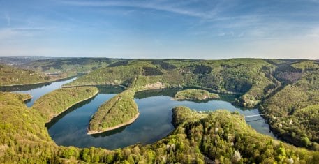
The Rur Eifel is made up of ridges that range from undulating to flat and which cut through the Rur and its tributaries. The larger streams generally have a meandering course and have thus created broad, U-shaped valleys. The Rur, the Urft, the Wüstebach and the Helingsbach flow in part through broad, U-shaped valleys, which has led to the creation of damp valley floodplains with forests or meadows.
Shore terraces dating back to the Ice Age can be found on some parts of the course of the Urft and Rur rivers. They comprise sand, stone and shingle, for example at Steinbach and on the northern shore of the Rur reservoir. These shore terraces attest to the fact that, during the Ice Age, there were increased amounts of rubble and erosion products, which from time to time became part of the riverbeds and which were subjected to the erosive force of the rivers – especially during breaks in uplift. This in turn caused the substrate to rise, increasing the erosive power of the water and saw the tributaries erode the deposited terraces.
The geology of the Eifel
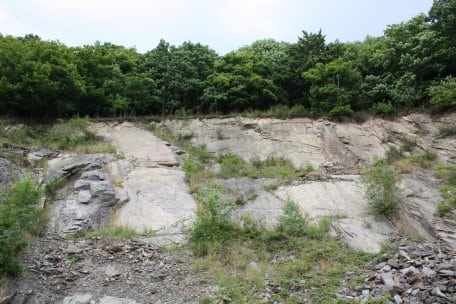
The Eifel National Park area and its surroundings feature rocks from three different geological periods: 550 to approximately 400 million years ago, during the Cambrium and Ordovician periods, marine sedimentation was deposited, which was then folded to form the Caledonian Orogeny. Primitive cryptogams and simple brachiopods can be found as fossils.
420 to around 300 million years ago, in the Devonian and Carboniferous periods, the sediments of the “Old Red” continent were deposited south of the equator as marine sedimentation and unfolded to become the Variscian Orogeny. Ripple marks, special fine stratification and plant chaff can be seen in the rock formations. Furthermore, this period saw the evolution of rooted plants and vertebrates, which can be seen in the fossils in the National Park (including the placodermi from the pteraspis genus).
Devonian rocks make up the majority of the upper, pedogenic layer of rock found in the National Park today. In the period up to the present day, this rock mass has been eroded and covered with new sedimentation. This includes the red sandstone, which was deposited during the Triassic period of the early Mesozoic era, around 250 to 200 million years ago. It can be found in small areas in the north of the National Park region (Hetzinger Wald) as well as in Kermeter to the east of the B 266 road.
Soils in the Eifel National Park
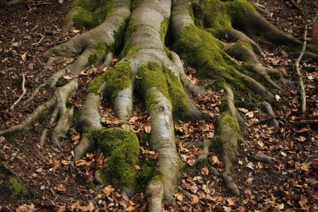
The soils found in the National Park today are the result of the different surface rocks and the impact that the climate, the relief, plants, animals and humans have had on them over the various periods.
Whilst predominantly brown soil with a range of characteristics has formed over the dominating Devonian rocks, podzols have developed above the red sandstone in the eastern Kermeter – encouraged by humans who have massively altered the vegetation.
In the steep hillside locations, the constant erosion of the topsoil has led to the formation of slope soil; in other words, soil with a very thin mineral and organic soil layer. The impact of groundwater and standing water in the tributary and river valleys and reservoirs, which have a higher clay content, has led to the development of pseudogley, gley, stagnogley, alluvial and muck soil. Finally, the adding and removal of soil to the former residential sites and on the ground previously used by the former military training area Vogelsang is evidence of the human impact on the soil surface.
The climate in the Eifel
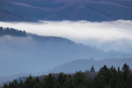
The climate in the National Park, which lies on the western edge of Germany, is strongly influenced by the Atlantic. The relatively mild winters and relatively cool summers with high levels of precipitation are characteristic of the climate here.
As our climate is dominated by westerly winds, most rain showers occur when the clouds meet the west-facing slopes. There is less precipitation for the other side of the ridges, i.e. the areas lying to the east of the slopes in the slipstream. The level of elevation also plays of role: in order to pass over high ridges, the air must rise, which in turn causes it to cool down more – this causes more precipitation to be released as the air passes higher altitudes. These two factors cause considerable differences to the amount of precipitation within the relatively small area of the National Park. In the southwesterly part of the National Park, it rains an average of 1,000 to 1,200 millimetres per annum; in the lower, northern area of Heimbach (northeast) there is, by contrast, just approx. 600 to 800 millimetres of rain.
The average annual temperature is affected in a similar way: it is around 6.5° C at high altitude and around 8° C in the lower regions. The vegetation period on the elevated areas near Wahlerscheid in the south is around 130 days – by contrast, the plants in the northern part near Nideggen have warm temperatures for an average of 30 days longer each year.


